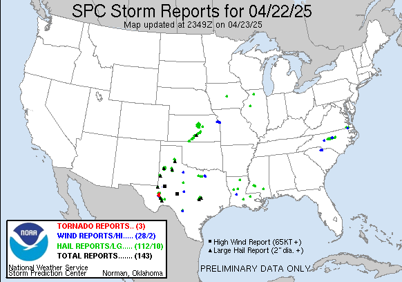
Good afternoon ladies and gentlemen!! Thanks for checking in tonight. Yesterday, we narrowly escaped utter doom and destruction all thanks to the culprit no wants, rain. Yes rain. If we had had many hours of sunshine yesterday, things would have been FAR worse than they were. Things were bad enough south of us. Check out this video and storm reports so far.
As we speak, a weak little system is moving across our area. This is firing strong showers and weak thunderstorms. Even the weakest of thunderstorms are capable of hail. This won't be very big hail, but we could get isolated warnings.
As we move through the next couple days, rain looks few and far between, which is good because much of the Ohio and Mississippi river valley's need a break. But As we head into the Sunday area, rain looks to return. Again. The GFS is showing the possibility training of thunderstorms along with this, which would NOT be good at all. After that, it's not showing a ton of systems coming through. Do I believe that? Absolutely not. The NAM is showing a similar picture as the GFS in the short term.
Now, I do think that this upcoming month will be absolutely MASSIVE in terms of tornado reports across the southeast, ohio valley, and into the mississippi valley. May usually has the most reports of tornadoes for a month in the year, so I do expect it to continue that streak.
That is all for now, thanks for checking in and God bless.

No comments:
Post a Comment