Thursday, May 12, 2011

Wow it looks cold next week.

Good afternoon everyone. Thanks for checking in tonight. As we are basking in the heat, the long term doesn't look too great, but I'll get there soon enough. Here are the current temps.


Hot, isn't it? :) Storms and warm temps will be abundant the next couple days. Clouds will also be with us as well. But, this low pressure system will likely become cut off and will produce constant showers and cold temps. Check it out.


I'm telling u if this was winter, we would have snow. Check out this temp chart for next week.


Well, thats all for now. Have a great day and God bless.

Monday, May 9, 2011

Severe weather possible the next couple days, and heat.

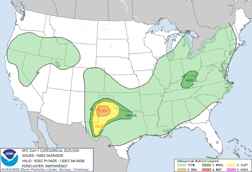
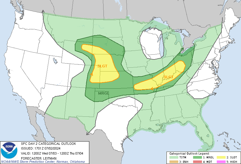
Good afternoon everyone!! Thanks for checking in. I'm sorry for the extended break I took. I just needed one pretty badly. Anyways, back to reality!! It is now very warm, and the area has a chance at severe weather later today and tonight. Here are the current temps and the SPC's outlook for severe storms.
As we move on through the week, tomorrow will be warm and may include severe storms. First if all, here is the latest SPC outlook for tomorrow's storms.
Secondly, temps will be rather warm this week. We are sitting under a nice ridge of high pressure which is bringing record warmth to areas that have seen too much warmth an not enough rain. It is also creeping the warmth towards us. The core will stay to our west, but we will definitely be feeling this warmth. The GFS is showing very warm temps until at least Thursday. The NAM is keeping temps a little cooler than the GFS. Here is the NAM versus GFS for Thursday.
NAM
GFS
I guess we'll have to see who's right.

Thats all for today, have a great day and God bless.

Thursday, May 5, 2011

Rain on derby?

Good evening everyone. Thanks for checking in and I have one question. Didn't it just feel swell waking up to low 30's this morning? ;) no it did not. I absolutely hated it. Especially since it's May, and we are like 2 days from derby. Anyways, here were this mornings lows.
Man, that 30 in Frankfort must have been cold!! Now, I know what a ton of you are wondering. What does derby look like? Well, the GFS is showing fine weather for derby on Saturday, as you can see here.
The NAM is showing a very similar solution as the GFS with isolated showers and rain. So what do I think? I do think that derby day will start off rather nice, and as the day progresses get more and more cloudy, and eventually, it will rain. At derby, though, I'll give a 40% chance of showers and thunderstorms.

So, looking ahead to next week, it looks nice, warm, and possibly stormy. As the warm up goes, temps may hit it big. The GFS is showing very nice temps, possibly summer like, by Sunday!! The GFS shows the warmest day falling on Wednesday, and temps may hit upper 80's!!
At the end of next week, we could see severe storms, but that is a LONG way off, so I'll focus on the next week.

Thanks for checking in and God bless.

Tuesday, May 3, 2011

Man, we had a lot of rain.

Good afternoon everyone. Thanks for checking as we near the end of this very rainy day. Man, I was worried about the rain not stopping. It is just storm after storm with heavy rain. Will that continue? More than likely, and that is not what most want to hear. Before that, here are the 72 hour rainfall totals for the NWS in Louisville's warning area.
Anyways, I do not see our pattern stopping any time soon. First of all, derby weather looks so much nicer than it did yesterday. Rain, if any falls, looks to be light. Temps looks to be nice, and possibly quite pleasant for Derby. Then, we start hitting a warming pattern. As this happens, it may set the stage for another severe weather outbreak. CAPE doesn't look amazing, but we are only 192 hours out on the GFS, so take anything you hear about this possible event with a grain of salt. Here is the possible CAPE and the GFS precip at that time.
CAPE
PRECIP
Of course, wind shear looks like it won't be high at this time. But we are forever and a day out. The EURO also shows extremely high temps early next week, which those would likely be coupled with very humid conditions. The only thing is, with the type of moisture in the ground right now, temps probably won't get too high. But I could be wrong. Just my thinking.

Thanks for checking in. God bless.

Monday, May 2, 2011

Rain rain rain. What an annoyance.

Good afternoon everyone. Thanks for checking in this cloudy afternoon. It has been raining a LOT the past couple days in western KY, and that is NOT what they need at all. Flooding is extremely likely, and rivers are rising, and rising pretty fast at that. Check out some of these river forecasts.
That is very insane. And rainfall is only going to continue training over those same areas as we move on into the next few hours. Check out the radar as this slowly moves east as well.
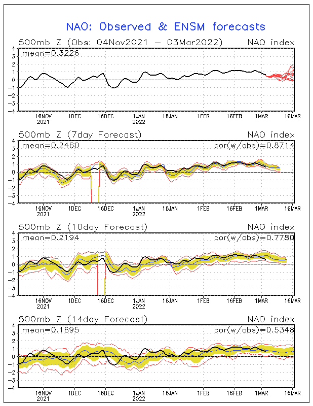
So, as we move away from this system, what happens next? Derby day is upcoming and I'm sure you are all excited. The GFS, at this time, is showing possible late day heavy rains and thunderstorms. At this time, instability looks limited, and therefore, severe storms look limit. I will watch this for you though. After that, temps look to try to jump upwards out ahead of a very slow storm system that may bring back the active severe weather. After that, I think the GFS goes on some type of drug because it is showing the month become quiet, which I do not see happening. However, the NAO is forecasted to go negative soon, which would send the severe weather threat away for a while. If you want severe weather, then that is not good. If you don't want severe weather, you probably praying the NAO goes negative. Here is the latest NAO forecast.
That is all for now. I will update later if needed. Thanks for reading and God bless.

Sunday, May 1, 2011

Heavy rains through the beginning of the week.

Good afternoon everyone. Thanks for checking in. Sorry for the lack of posts the past couple of days. Before we get into anything, it ha been a very long week for the people in Alabama. A very large amount of people have died, 300+. The number of tornadoes may have also surpassed the total of April 3-4, 1974. It was insane. Anyways, temps will be warm today and rainfall abundant. Check out the latest rainfall totals here.


Heavy rain is moving our way, and may train for several hours producing flash flood potential. There is a flood watch out, and is in effect through Monday afternoon, and possibly beyond. This batch looks rather ominous, and I think it could produce a good amount of rain over a short amount of time. Here is what this batch of rain will look like coming in.


Watch for high water and flash flooding with that one. After this system moves on out, things will likely get a bit cooler. Highs will likely end up in the 50's for the next day or two, which won't be pleasant given that clouds will be in place.

That is all for now. Thanks for checking in and God bless.